back to main

Homelessness in Oregon Public School Districts

Proportion of the student body navigating homelessness in the 2018-2019 school year

This map shows, for each public school district in Oregon, the percent of students reported to be navigating homelessness during the 2018-2019 school year. Here, "navigating homelessness" refers to students in K-12 public schools and children ages 3 to 5 in public preschool programs who lack a fixed, regular, and adequate nighttime residence during the academic year. Each school district’s Homeless Liaison identifies and annually reports information on homeless children and youth to ODE. You can read more about student homelessness and access the data used to make these maps on the Department of Education's webpage for the McKinney-Vento Act.

Preview of the map showing homelessness in Oregon school districts. Click to see the
        map in full resolution.

This map combines the data from ODE with spatial data for school district boundaries from the NCES.

How was this map created?

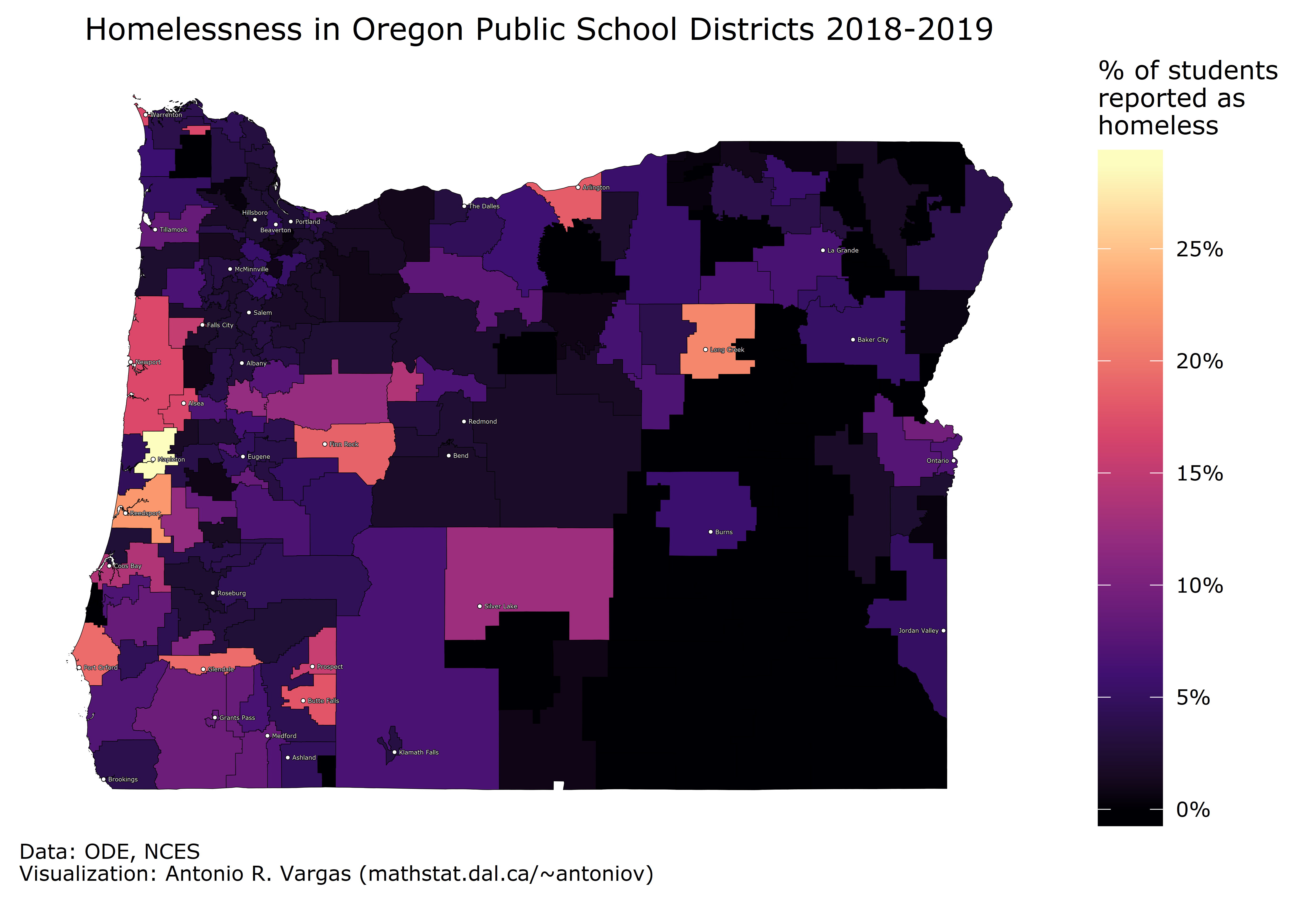
I made this map using the R programming language. Click here to read my writeup of the process. The writeup fully details how to obtain the raw data and includes complete, reusable source code for making other maps like this one.

Motivation

I was inspired to make this after reading Natalie Pate's 21 November, 2019 article in the Statesman Journal:

Oregon students experiencing homelessness on the rise again, report shows


Antonio R. Vargas
4 Mar 2020